Printing Martin Behaim's Globe
I recently was looking through Wikipedia’s Early World Maps article, and stumbled upon the oldest surviving globe from 1492 called the Erdapfel, German for ‘Earth Apple’. The globe was produced by German merchant and cartographer Martin Behaim, compiling knowledge of the world from various explorers and geographers.
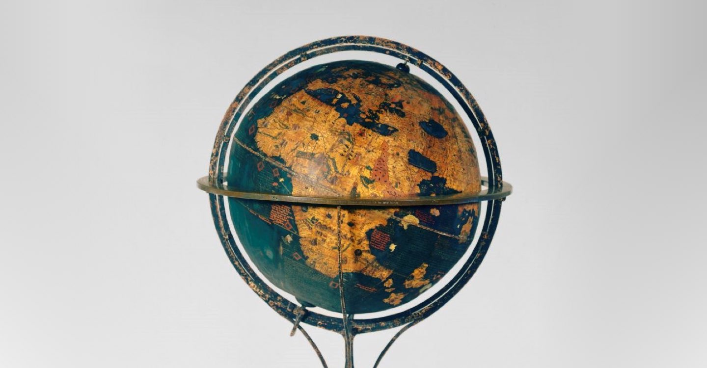
Martin Behaim's Erdapfel
© 2019 Germanisches Nationalmuseum, CC BY-SA-4.0, Wikimedia Commons.
A full 360 view of the globe can be found on YouTube.
The Americas are not featured on the globe as news of the new continent would only reach Spain in 1493, a year after the globe’s creation. But there are other problems, such as the earth’s circumference being too small (which explains why there isn’t even room to add the Americas), the Deccan peninsula (India) being non-existent, and Southeast Asia and Japan being hyper-exaggerated. Not all mistakes are attributed to Behaim, though one researcher describes Behaim as “not a careful compiler”.[1]
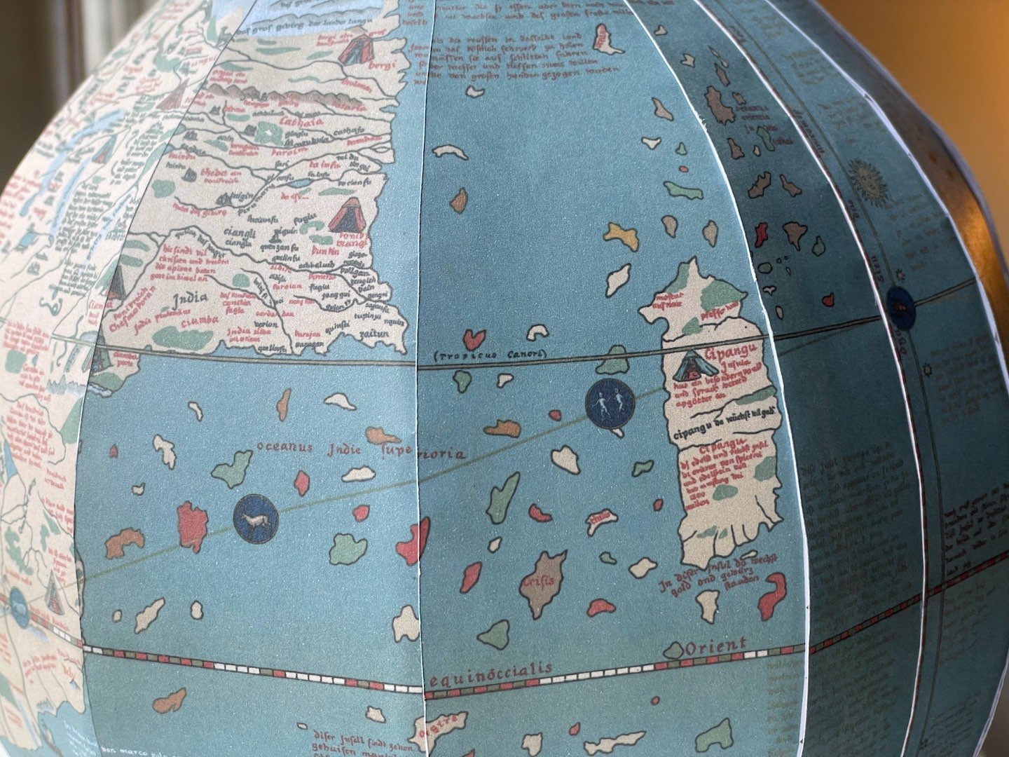
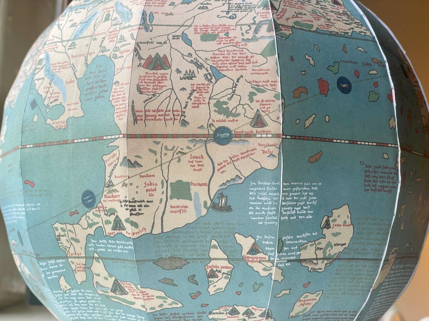
But for all its flaws, the globe is an artistic masterpiece, featuring hundreds of place names, over a hundred illustrations, and several anecdotes from travellers like Marco Polo.
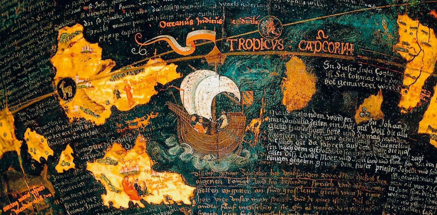

Annotations cover the entire globe.
© 2019 Germanisches Nationalmuseum, CC BY-NC-ND-4.0, gnm.de.
This post won’t cover the fascinating details of globe itself; Ernst Georg Ravenstein in 1908 has already done this. You can find his transcripts and commentary of all the annotations on the globe in the book Martin Behaim, his life and his globe.
What piqued my interest looking on Wikipedia was the following image that Ravenstein made. A recreation of the globe in “12 globe gores and 2 polar calottes”.
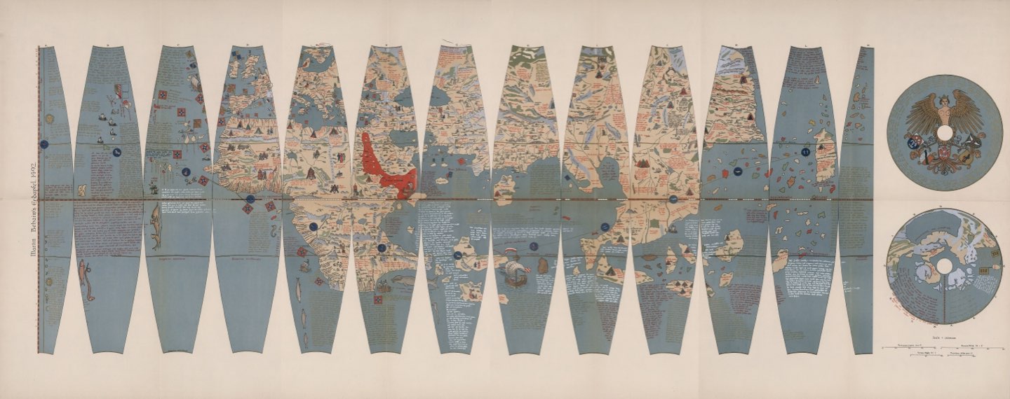
Composite of Globe Gores 1-4: Facsimile of Behaim's Globe
By E. G. Ravenstein, published 1908, David Rumsey Map Collection.
This recreation is not an exact copy. The illustrations, colours, typography look slightly different to the original globe. But the substance is the same, down to the corrupt spellings of place names. Ravenstein seems to have started research in 1899[2] and published his work in 1908, including carefully studying other facsimiles that were made in the past. It’s astounding the amount of effort Ravenstein put into this.
A high-resolution scanned copy of the manuscript can be found at the David Rumsey Map Collection, in 4 parts. They also have reprojected the map into other projections, including an interactive globe!
The arrangement of gores and calottes made it very tempting to see what it would look like assembled as a globe. So that’s exactly what I’ve decided to do here!
Constructing the Globe
The original globe is roughly 50cm in diameter.[3]
I had no interest in recreating a 1:1 scale of the globe, but it would technically be possible to create one with just an A4 printer if one cut the gores into northern and southern hemispheres.
Instead I decided to go for a 20cm diameter globe. So in a graphical editor I extracted the shapes of the gores and calottes. I then wrote a script that would scale the images to the dimensions I needed to print. To save paper, I used a box-packing solver to optimise which images fit on as few pages as possible.
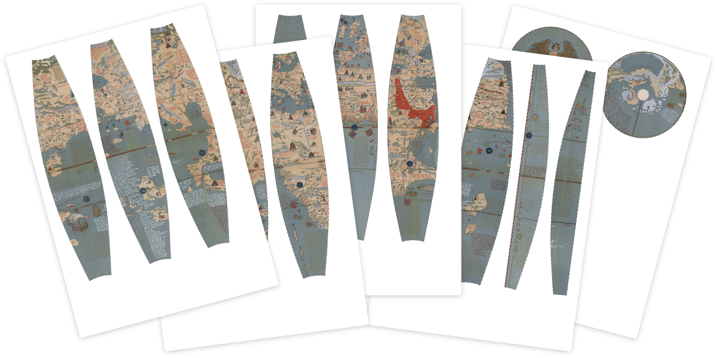
I then printed the images using an inkjet printer with 120 gsm paper.
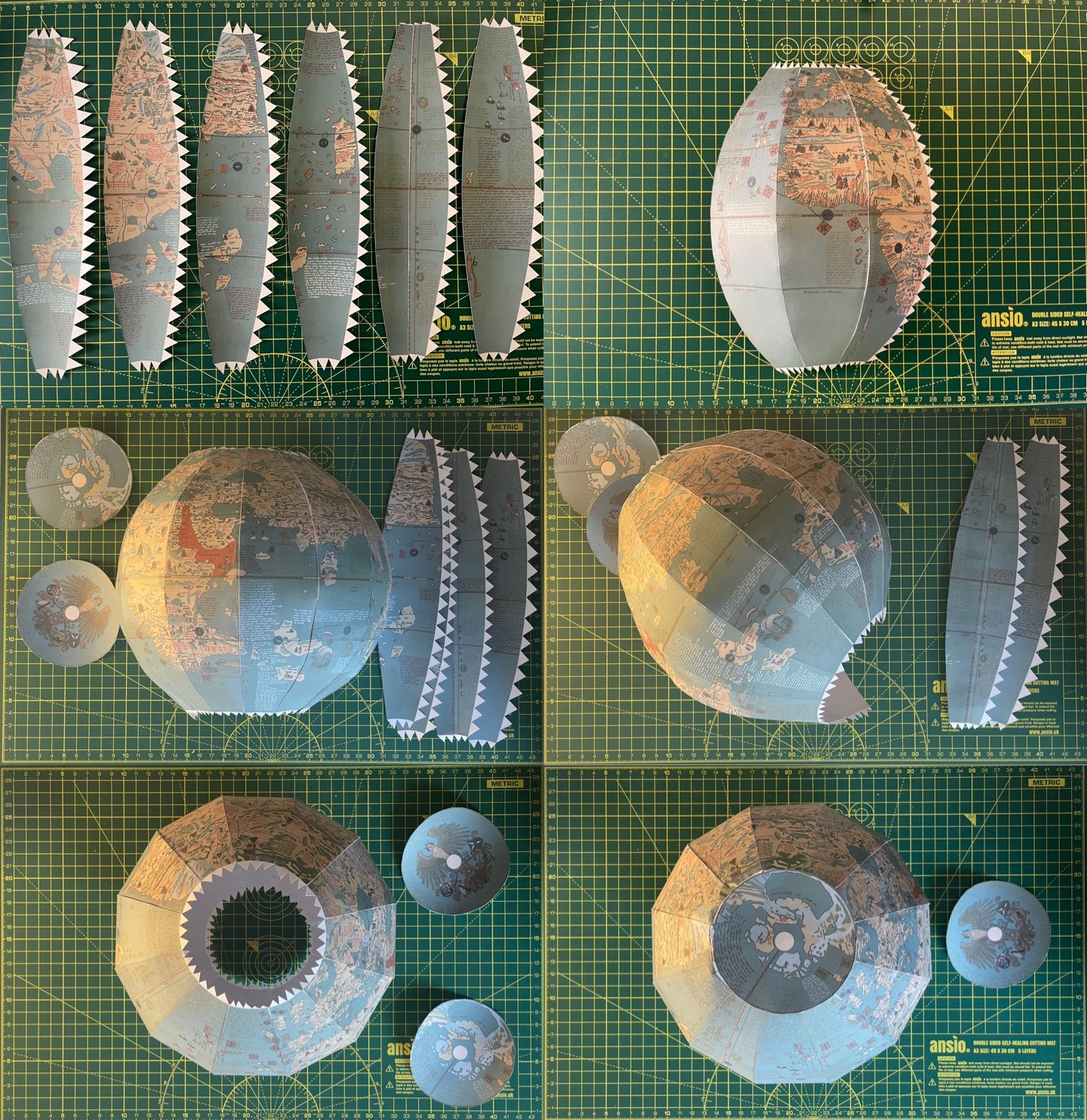
To stitch them together I cut out the pieces with a hobby knife, making sure to include triangular tabs on some of the edges so the pieces can be glued together.
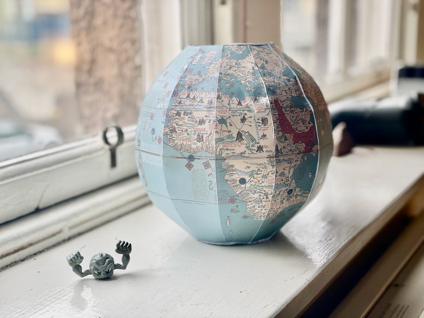


I’m happy with the globe, but some improvements could be made.
Firstly, I probably should have gone for a 25cm diameter globe, as a lot of the text is too small to read. It also doesn’t help that the original scan has gold on blue which makes the text illegible.
Secondly, I should have had more patience glueing it together. As I worked my way round the globe I got better at getting the tabs to stick, but the initial sections (Africa/Europe) don’t look great. I could have also planned placing the polar calottes better, since the tops are a bit wonky.
I want my own Behaim globe!
Well then you’re in luck! All you need is an A4 printer with decent print quality and thick paper (Ideally something better than 120 gsm). Below are printouts for globes in various sizes.
- 20 cm diameter (5 pages)
- 25 cm diameter (6 pages)
- 50 cm diameter (26 pages)
If you need a more specific resolution, you can also use the scripts I’ve written at erdapfel-papercraft on GitHub.
Note: Technically these PDFs are licensed under Creative Commons BY-NC-SA, 3.0, as they are derivatives from David Rumsey’s Map Collection. Arguably, scanned copies of material that is in the public domain is not copyrightable, but I’m not a lawyer.

Citations
References
- Martin Behaim, his life and his globe – Ernst Georg Ravenstein, published by G. Philip & Son, ltd., 1908
- High Resolution 3d Modeling of the Behaim Globe – Menna, F., Rizzi, A., Nocerino, E., Remondino, F., and Gruen, A. published in ISPRS: International Archives of the Photogrammetry, Remote Sensing and Spatial Information Sciences, 115-120, 2012